


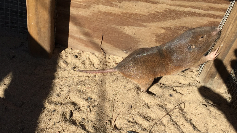
The southeastern pocket gopher (SEPG), a small but mighty ecosystem engineer, is getting a much-needed spotlight thanks to a project using remote sensing to map its distribution across Florida. With a $7,313 grant from our Foundation, courtesy of our Conserve Wildlife License plate, FWC is utilizing satellite imagery to pinpoint SEPG’s current range, research never completed before.
The best part? It can all be accomplished from a computer screen.
These burrowing rodents play a crucial role in maintaining the longleaf pine ecosystem, a habitat that has dwindled by 98% due to development. Understanding where SEPG populations thrive (or not) will provide vital insights into conservation strategies that protect both the species and its fragile environment.
What makes this project especially fascinating is its methodology. Using high-resolution satellite imagery, researchers divided Florida into thousands of 1-kilometer squares, then zoomed in on each one to look for the telltale mounds left behind by burrowing southeastern pocket gophers. These mounds are surprisingly easy to spot in longleaf pine forests thanks to their open canopy, which allows clear satellite views of the forest floor. By scanning each square and recording where pocket gopher activity is visible, the team is building a detailed, up-to-date map of where the species currently lives. They’ll then overlay this map with data on soil types, land use, roadways, and conservation lands to figure out what’s helping or hurting these tiny underground engineers.
So far, researchers have surveyed about 20% of the designated grid squares, refining SEPG’s range map with greater accuracy than ever before. To keep the momentum going, FWC has developed a volunteer training program, allowing conservation-minded Floridians to contribute to the project from home, no boots on the ground necessary.
You can support work like this by purchasing a Conserve Wildlife license plate. Match your plate to your passion.