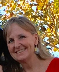
 Kathleen Gibbons has been fascinated with geography since early adulthood. She liked the broad scope of the subject and the great variety of topics she could investigate. After completing college, Kathleen worked for the National Wetlands Inventory for 10 years, which introduced her to computer mapping via geographic information system (GIS). GIS is a framework for gathering, managing, and analyzing data. It is computer based and allows you to recognize the spatial organization of the planet and see order in what appears to be random scatterings of people, places, and environmental factors. GIS helps researchers make reasonable decisions about topics involving relationships between the physical environment and society, like sea level rise.
At FWRI, Kathleen leads a team that uses GIS to explore environmental issues like sea turtle disorientation. Turtles use the natural light horizon to help them find the ocean, but sometimes lights distract and disorient them. The team uses the latest GIS technology to capture information about nesting and hatchling turtles that have become disoriented in this way. The use of GIS technology has allowed researchers to analyze a season’s worth of data in real time. In the past this data was not readily accessible until after the nesting season was over. Now, with the help of GIS, FWC can intervene when turtle disorientation events occur.
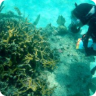
Kathleen has also assisted with the Marine Biodiversity Observation Network (MBON). MBON is a part of a global biodiversity network that compiles biological data and monitors the marine biodiversity of the nation’s coastal and shelf waters. MBON is interested in all levels of diversity in a region. The lower level includes habitat types within a region; the middle level includes species diversity; and the upper level includes genetic diversity within species. Kathleen’s team combined all GIS data layers for the Florida Keys National Marine Sanctuary. The data was then put together on a website so the data could be better visualized. Staff also constructed a species distribution model for the Sanctuary using Ecopath. Ecopath is being used to create a food web and answer complex management questions. For example, Ecopath can be used to better determine ecosystem effects of fishing, the impact and placement of marine protected areas, and effects of environmental change.
Kathleen loves the different projects she gets to work on and the constant evolution of the software and tools. She also enjoys the creativity allowed in GIS work and the ability to show people their research in new ways.
Researchers like Kathleen and her team work to protect Florida’s beautiful landscape and the wildlife that calls it home. To support their work, donate here.

